Wednesday, October 22, 2008

Mt Rogers write up

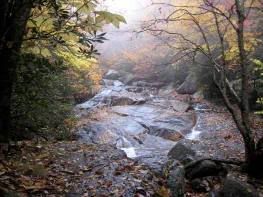
Wilson Creek, Mt Rogers


On Oct 10-12, 2008 the NC Chapter ran an educational basecamp outing instructing in the art of backcounty navigation. Our focus was learning basic map & compass skills in outdoor classes held over the weekend. We honed our new skills during a day-hike on Saturday and a workshop Sunday morning. Our Saturday hike wound it's way through the Wilson Creek basin, crossing Quebec Branch, and ascending Wilburn Ridge for some focused map and compass work, plotting bearings to the Scales and to 1st Peak. Afterward a large part of the group scaled the highest rock outcropping for a 360 degree view of the area, and stayed up there until completely oriented to the area, or perhaps because the view with clear skies was astounding.


We had lunch near the North end of Wilburn Ridge and afterwards shared a didactic talk about navigating using input from nature, say how to estimate your latitude from the position of the North Star above the horizon.

The outing was well attended with 13 participants, including some old hands, several new Sierra Club members, and Maria Bowling, Outings Chair for the New River Group in Virginia. Mt. Rogers proved to be a perfect location, with cooperation from all the folks at Greyson Highlands Park, and cooperation from the mother nature as well.

This area offers challenging terrain, with hiking trails and horse trails intersecting or sharing territory, and ridges folding into each other: "is that Wilburn Ridge, Pine Mountain, or 3rd Peak?". As we saw around Wilson Creek, it also contains the "Bermuda Triangle of the AT", where North is South, and South runs North!


Monday, October 13, 2008

MT Rogers Navigation Trip

I'm just back from MT Rogers, were we had a great 3 day class learning and practicing map and compass skills in the backcountry. The fall leaves were spectacular, we enjoyed two days of hiking along Wilson Creek, Quebec Branch, and Wilburn Ridge, and our campfire discussions were fascinating.

During this outing we covered a wide range of topics in class around the campfire. I'll update our Backpacker Book list to reflect the books and movies we discussed.

Thanks to all who participated! Feel free to comment on the trip here. I'll also be interested in your thoughts on other outings that you would like us to run.

I'll look forward to seeing you on the trail soon.

Friday, October 3, 2008

VOTE for Fires Rim Creek Trail

I just got an interesting email from Chris David, one of our local SC Outings Leaders, and Jeff Hunter, a field organizer for Southern Appalachian Forest Coalition.

Chris and Jeff are asking you to support a grant to rebuild the Fires Creek Trail in Western NC, " a beautiful 25.5 mile loop trail with a number of linking spurs to the top (of the rim)".

Here's what Jeff says "Fires Creek Rim is in the top 20 finalists for a $5000 Nature Valley grant. Recipients will be determined by the number of votes received. Please have EVERYONE you know go to the link below and vote for Fires Creek Rim Trail. This will help us draw attention to the area and the issues, and help clear a lot of the blowdowns."

Please go to this link to VOTE for Fires Creek Rim Trail!

I hope to post a more in-depth article on this in the NC Outings Calendar in a little while.

chris in nc

Mountains to Sea Trail Hikes

Our buddies over at MST have a couple of October MST hikes on the 5th and 19th that they have passed on to us.

Arthur Kelley is leading the hike on the 5th and Jim Suiter is leading the hike on the 19th.

See this link to Arthur's hike.

See this link to Jim's hike.

Happy Hiking in October
The NC Sierra Club